Averting BER Floor with Iterative Source and Channel Decoding for Layered Steered Space-Time Codes
 9 min read
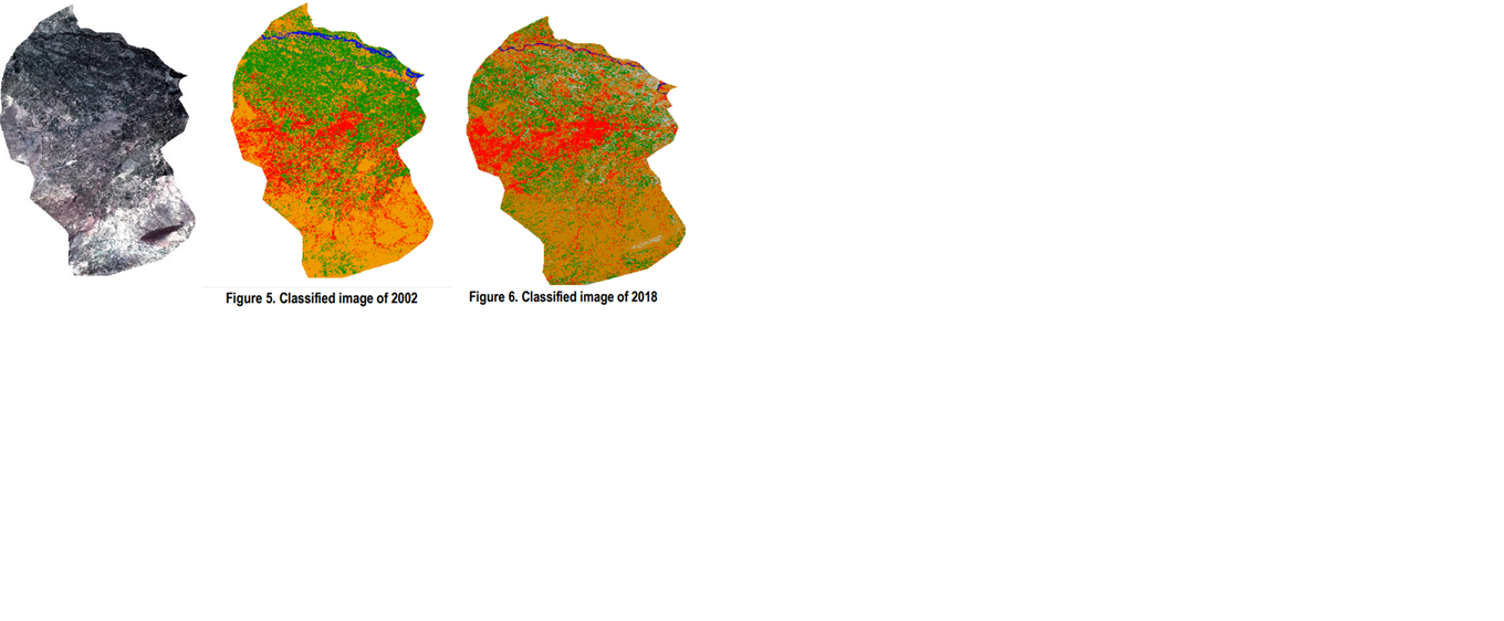
Remote Sensing is a concept to analyze objects on the basis of their radiation i.e. their response to the sun radiation (or any other radiation used by the active remote sensing). As the population is almost going to double every 50 years, it is very important that the administration have special plans to make the availability of basic resources to the masses. So, remote sensing is very helpful for urban planners in that case to study an area and come across different solutions. Here we have selected a specific region and discussed its land cover change detection on the basis of Landsat satellite imagery acquired from United States Geological Survey (USGS) earth explorer. This will also give some of the basic concepts of classification methods. Classified images give us the results, generated through comparison of satellite data acquired in 2002 and 2018. The results show devastating change in urban infrastructures, vegetation and water bodies. There has been a substantial increase in urbanization since 2002, following major events in the area e.g. the inflow of Afghan refugees during and post war. Due to 12.46km2 increase in urban area of Peshawar and a decrease of vegetation of about 143.8km2 we are facing major issues in urban sprawl in Peshawar. Moreover, the depletion of water bodies is recorded to be 11.85km2 since 2002. The work also briefly describes two classifiers, maximum likelihood and minimum distance, which we used for our study.