
The Fire at Karamar Mountain, through the eyes of Remote Sensing
A Team of Engineers at NCBC UET Peshawar used satellite image analysis to estimate the damage caused by the fire that broke out at the Karamar Mountains.
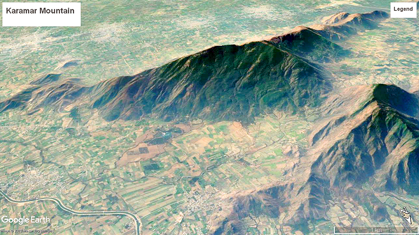
Fig.1 - Image of Karamar Mountain, Sawabi. Taken from Google Earth
On the eve of 7th June 2019, on-going traffic along the newly opened Swat Motorway experienced something out of the ordinary. From afar it appeared to be a chain of lights in the night-sky, resembling a scene from a sci-fi movie. It was a fire that had broken out at the Karamar Mountain between District Sawabi and Mardan. The sheer scale of the fire was so large, anyone travelling on the motorway after Eid witnessed it. The authorities were informed quickly and efforts were made to control the fire.
However, the question is - How much damage did this fire cause?
In order to ascertain the damage of the fire, a Research Team at the National Center of Big Data & Cloud Computing (NCBC) took on this task. The Research team operates from a state of the art research lab located in the premises of UET Peshawar. Their team includes engineers that are experts in Remote-Sensing and GIS technologies, along with Faculty members who have plenty of experience in this area of interest.
The team prepared a comprehensive report highlighting the total scale of damage caused by the fire and also suggested the location where the fired originated. Since the team specialises in remote sensing technologies, a detailed analysis of historic satellite imagery was conducted which yielded Key data points by analysing visual geographic data i.e. assessing the vegetation damage done by the fire over its course.
To understand the findings of the report below are some images from Google Earth showing the view of Karamar Mountain.
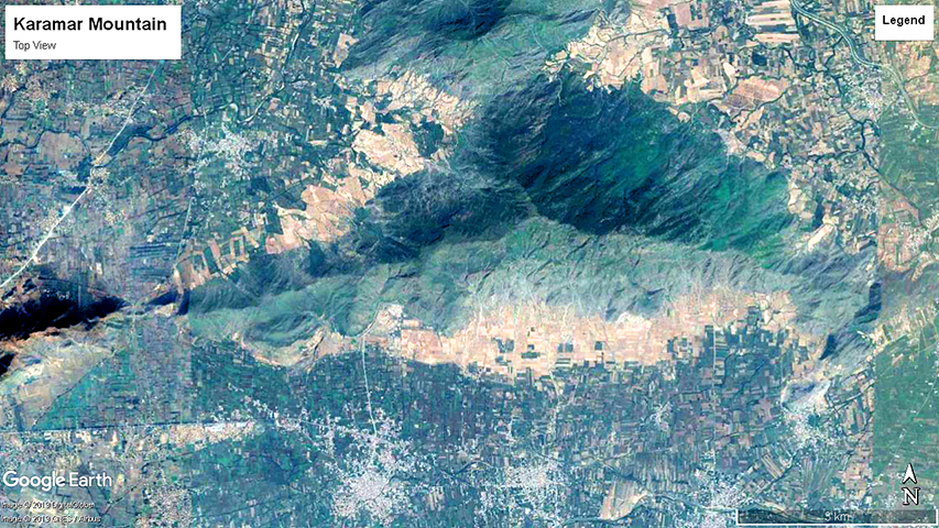
Fig.2 - Satellite View of Karamar Mountain, Sawabi. Taken from Google Earth
From these satellite images, the engineering team removed urbanisation, extracted portions of the mountain from the map and applied sophisticated computer data analysis algorithms compiling an animated timeline, to showcase the damage caused by the fire from the day it started.
Ranging from day 3 to day 13 of June here is a transition animation of the satellite images both before and after the fire. In technical terms, this is known as the Vegetation Index Model.
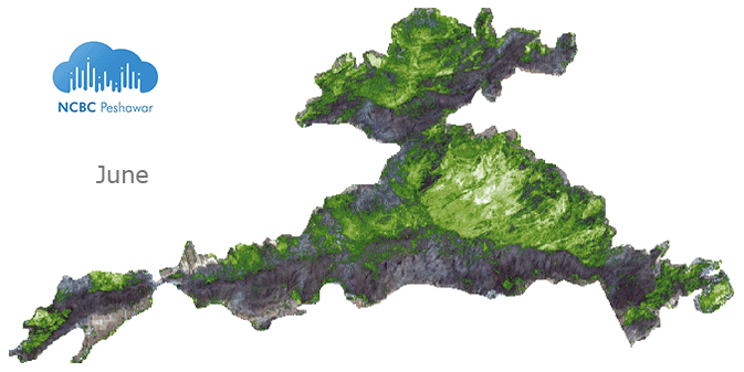
Fig.3 - Spectral Image of Karamar Mountain by NCBC Peshawar. Before and After the fire in June 2019
The same transition is animated in a different model here. Black indicating burned areas.
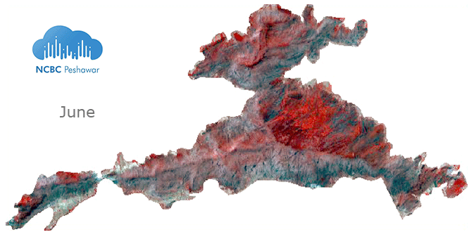
Fig.4 - Spectral Image of Karamar Mountain by NCBC Peshawar. Before and After the fire in June 2019
Visual appeal aside, how extensive was the damage to vegetation?
Engr. Waleed Khan, lead of the NCBC Remote Sensing research team, gathered extensive details on the event, of which he shares the following figures -
The total Mountain area is around 5,000 Acres. The area is covered mostly with evergreen conifer trees to the north and shrubs to the south. The fire spread nearly 2,500 acres which is 50% of the total mountain area. Before fire damage, the healthy vegetation on the mountain was estimated to annually produce oxygen for over 65,000 people, and consume around 25,000 tons of CO2 gases per year. Nearly 30% of those figures are now lost to the fire, with acres of forest and vegetation severely damaged. Not to mention the amount of CO2 gases produced by the fire that adversely affects the climate further.
However, the phenomenon of forest fire is completely natural and is part of the forest’s ecosystem. These trees are highly resilient, and if given the right conditions and with the rains to come this season, these trees will flourish again and grow even stronger. Fire is the least of our worries when it comes to forest damage, however, it is deforestation that needs our attention. These trees are vital for life on earth. As the largest plants, they produce oxygen, store carbon, stabilise the soil, and it cleans the air around us. Pakistan has been facing strong climate backlash, in the form of floods and drought, and deforestation is a major cause for such calamities that affect all of us. Thus more efforts need to be put in toward reforestation around the country.
The team believes Remote Sensing technologies can help planning and policy-making institutions make more informed decisions that are based on factual data. Concurrently they are working on other similar projects, including estimation of crop production, and also on the recent case of the recent massive Locust Attack on crops in Sindh.